
We believe that understanding history helps make for a better future and that the methods of presenting and distributing it are important.
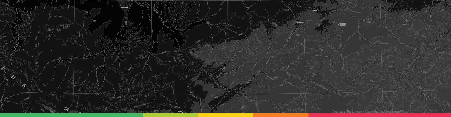
Why an interactive map? Maps are one of the best ways to clearly show an enormous amount of information in a small area. Adding interactivity further improves this density-to-clarity ratio. Since everything in the past took place at a certain time and location, maps are an obvious choice to visualize that knowledge. Understanding history requires seeing changes and interactions over time, and a four-dimensional map allows this.
How should data be collected? Given the enormity of the task, content needs to be crowdsourced, along with major pieces of the technology stack open-sourced. Historic map data has been collected for many years by organizations around the world. Keeping this and any new data open increases its accuracy, speed of collection and availability to everyone.
 Help contribute to our open-source API and map editor! We use tools like Node.js, Mapnik, Leaflet, and Postgres. If you like what we're doing and are familiar with the tools we use, we'd love to hear from you.
 Are you experienced in GIS or cartography? If you’re familiar with ESRI software, QGIS, or any other map-making tools, join our community and start contributing.
While we're busy building Atlastory, join the community and get updates on our progress.
We'll keep your email private and message you only when there's a major update.
If you've got any suggestions or feedback, we'd love to hear from you at the email below.
Contact Us